The Long-Awaited Trolltunga
~Steve~
Finally, what many people have been waiting for...the trip to the troll's tongue!

Where to start and where to begin? Hiking Trolltunga was one of the first decisions we ever made when we first arrived in Norway. How we were going to get there and where to buy everything we needed was issues we would later figure out, but that was the plan, nonetheless. So, once we met our friends Thomas and Sina who also were very eager to hike it, a plan was put in motion and here we are today, nearly 6 weeks removed from the trip, ready to share an amazing hiking journey.
Our trip started on September 2nd, quite early in the morning for Anna and me, but not for the reason you would think. We had class unfortunately early that morning, so it was a nice 06:30 wakeup on a day where more sleep would have been quite nice. After class, we finalized our packing and then met up with the other two at the tram stop. We had our bags, some food, hiking clothes and boots--we were essentially all set. Our car rental was waiting for us around noon, so we took the tram to the airport and picked the car up after getting a little lost and confused looking for it. It seems to be a common trend, at least for me, to be feeling just a little lost in Bergen whenever I need to find something. Weird.
Hopping into the car, we stopped off at a grocery store to grab some food for the drive and a bit of stuff for the next day before heading out onto the highway. And what a scenic (and treacherously narrow) highway it was. There were some sections that were so thin, there were reflective mirrors on each corner so you would know whether it was safe to drive ahead or if you should wait for a car to drive through first. We were driving to the town of Odda, which was close enough to the trailhead. It was only a couple hours of driving to get there, but the views were awesome. There were several long tunnels (one that took ten minutes to drive through) and a quaint ferry to take across a fjord. Overall, a really nice drive to begin the trip with.


Once we arrived in Odda, we checked into our hostel and dropped our stuff off before deciding to grab food and drinks for Saturday night, on the off chance we got back into Odda after all the stores close. Props to Thomas for this idea. It paid off the next night! We fuelled up on pasta the night before with a nice mountainous sunset near a fjord as we planned the next morning. And what an early morning that was to be.

Saturday, 3rd day of September. It's 05:15, what were you doing? Sleeping? Ah, that sounds lovely! We were getting ready for our hike. We were warned to get to the parking lot for the trail early to ensure we got a spot, and thankfully, we did! There are three parking lots to choose from, all cost a little more the closer you are to the top. P1 is close to 9km away from the trailhead, so you have to walk along a narrow road to get to P2, which is still 4.5km from the start of the actual trail. P3 is lovely, but it does cost the most to park there, so we made the economical decision and chose P2, as most people do. Though we didn't do the other thing most people did, as we walked up the 3.5km of switchback roads instead of paying for the shuttle bus. I'd recommend parking at P3 if anyone decides to go, you'll thank me later. Trust me.

We started our hike just before 07:00 feeling pretty good, feeling full, and ready to go. It was a chilly morning, but as Anna says, "be bold, start cold." Gets the blood pumping and your heat up early, so you're not constantly removing layers before you even start the trail. There's not much to say about this first stretch, but the views at the end of each switchback was quite nice. I waved at most of the shuttlebuses as they continuously passed up as we made our way up. About an hour later, we had made it to the trailhead, where we took a quick water and snack break before the real hike began.
The first few km of the trail began with a few metal bridges over some running water, gradually changing trees and shrubberies, and lots of flat rock faces to run across. As we kept going, the trail opened up to a massive, sloped plateau surrounded by mountains. The greenery had given way to the rocks, moss and grass we would be seeing for the rest of the hike. There were several small streams flowing down through the rocks, with some cool cabins on display near little ponds. What a wicked view those cabins would give each morning. As the sun slowly rose from behind the mountains, we got to see the trail take shape before us. I didn't like it.

We were approaching our first (and thankfully only) red zone of the trail. This trail was divided into different sections: red zones (extremely steep and difficult), orange zones (steep and challenging), yellow zone (prolonged incline requiring some careful footing), and general trail zones, which were generally flat save some gentle slopes. This red zone started off with countless loose steps made from large rocks. We greeted and sympathized with many of the folk we passed on the way up this part that we struggling to power through, particularly so early in the morning. The sweating truly began at this part, though our hope that the stairs would soon be over were only quashed when we saw the daunting, flat rock face scramble that was awaiting us next.
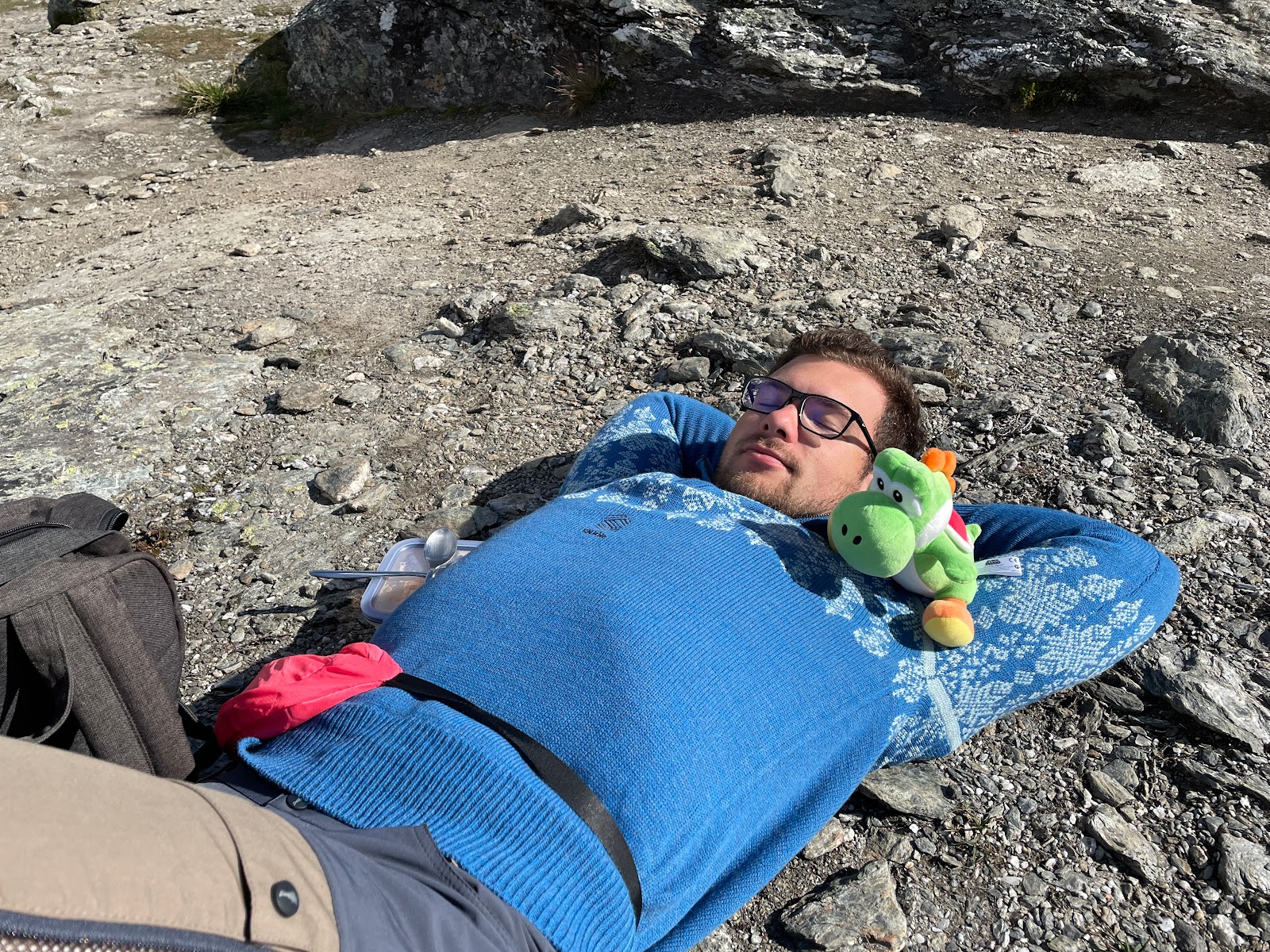
This part sucked going up. It was a little slippery, but it was a little scary just trying to keep your footing right with such a flat slope. And it seemed to never end! It just went on and on and up and up and up...We agreed to get to a certain point before taking our first meal break as it was getting close to breakfast time for us, around 09:45 or so. We found a small plateau to the right of the trail and turned around, revealing the amazing view of the valley below us that we had just trekked through. The hills were alive with birds, though the serene silence of the mountains was incredible. This view would have been worth the trek out regardless, but we were not even halfway there yet! So, after some food, drink and rest, on we went again.
After debating whether we had reached the end of the red, flat rock section for what seemed like an hour, we made it to the top of the mountain range that we would be trekking along! We were nowhere near our final height, but we had made some serious progress. This is where the scenery took another, rather pleasant change. Much of the small shrubs and short trees that kept us company along the first part were gone, and the landscape gave way to millions of small rocks, moss, short grass, and lots of crystal-clear glacier ponds. Behind us lay numerous snow-capped mountains, and ahead was something out of a picture. Looking back, there were times I had to pinch myself to realize I was actually looking at these vistas, instead of staring at a painting or something.

The next few kilometres, while beautiful, were much of the same. Gradual uphill, followed by a flat portion and an amazing view. The scenery was getting a bit greener again, as we left the rocks behind in favour of some pleasant, busy meadows. It was approaching midday as the valley below revealed itself, and we could truly see just how far we had climbed. You could see the thousands of years of erosion, and how the melting and movement of the glaciers had shaped so many of the mountains. We got to one section which gave an incredible look into the fjord below, with its slightly dangerous downhill slope towards a cliff of immeasurable height. Some of the amazing things about this trail is the free-flowing water that we passed over and over again. It was glacier water too! I filled up my bottles many times, and the taste of it never got old. I did get sick immediately after this trip...but nah I could not have been the water. I started feeling a bit sick right before the trip, so it had to be something else, right? Regardless, drinking water from a glacier is now checked off my bucketlist!


We continued climbing higher and higher and before long, we could see where our trail was leading us, and we spotted the first sightings of our final destination. Truth be told, we had no idea where Trolltunga proper really was, but on the way back, if you looked just carefully enough, you could make out the ledge and all the people trying to snap a quick picture.

The meadows gave way to rocks once again, but this time, an empty riverbed was our companion as we trekked down towards a small gap in the mountain cliffs. We crossed a short metal bridge and climbed up a few hundred more metres until we saw the 1km sign. We were almost there! And just in time too, as our weary legs were exhausted after nearly 5.5 hours of intense uphill hiking. We clamoured over boulders, jumped over streams, past small glacier ponds and then there it was. Trolltunga. It was nothing like I thought it would be, but it was stunning. The views were immaculate. The sheer height of the cliffs and the ledges would terrify most. What a place.
We'll include as many of the photos as we can, you can't get enough of this view. We stayed at the top eating, talking, joking, taking pictures, and resting our legs. The sun was shining, and we were soaking it all in. It was warm, comfortable and beautiful, what else could you ask for? Anna and I decided against the long wait to take a picture on the troll's tongue, but as the line got shorter, Thomas and Sina took their shot, and we got lots of amazing pictures with them on the edge of the world! After that, we decided it was time to head back, and so the trek down began.


There's not too much to report on the way back down that differs from our ascent. Though, one thing is for sure--we were all getting really tired. The way back went much quicker thanks to many downhill sections. We filled our bottles with more glacier water and continue the trek, taking some more photos of the view as the sun slowly began to go down in the afternoon sky. We ran into some other friends from Fantoft who were camping at the top with the stars above and wished them well. We warned them to go slow and enjoy the view, and to take some photos of the sunset for us too.
We took a middag (a Norwegian meal eaten around the late afternoon) break at the same spot we had breakfast at before climbing back down that steep, red-zone rock face. It had gotten a lot colder in that time, though we had the sun shining on us, so we went between getting cold and hot quite quickly whenever there was a hint of shade. I am not sure about the rest of the group, but this was where the problems starting occurring for me. I had only recently bought some nice hiking boots just before we left for Norway, and I had not fully broken them in before embarking on this endeavour. The blisters on my feet were large and quite pronounced at this point, making each step painful. Thankfully, we only had about...oh wait, another 6km to go. Great.

This last part of the journey, at least for me, sucked. I was tired. My feet were blistered, cramped, and incredibly sweaty. My back hurt from the heavy backpacks we were carrying, and my face was starting to show just how burnt it was. When we got to the trailhead again, I was so sad to remember that we still had many more kilometres to go. And down a steep switchback road at that. I didn't even have the energy to enjoy the nice views going down, but before long the torture of that road was over and we all enjoyed a little sit-down in the car before travelling back to the hostel.
As mentioned early, Thomas's plan to get pizzas and drinks the night before was genius, as we did not get back to the car until about 19:00, and not back to the hostel until closer to 20:00. We took turns showering while we baked the pizza, then had some drinks while eating. Before long, we were all tired and wanting to relax, so we put on Cars 2 and that was that! I don't remember what happened after we turned it on as I fell asleep fairly quickly (thought you'd be proud of me for that one, dad).
Sunday morning came, and after tidying up the room and making some scrambled eggs, we were on the road again. We visited a unique little town with a cool waterfall, enjoyed the long tunnels and scenic views, and hated just how narrow the road got. We arrived back at Fantoft in the late afternoon, said our goodbyes and farewells, and Anna and I went straight up to the room and collapsed on the bed. What a trip!

27km in one day. 800m elevation gain. 12 hours on the trail. Dozens of cool rivers, ponds, lakes, and waterfalls, all fed by the glaciers further in the mountains. And one hell of a view. Would I recommend this trip? Absolutely! However, I would give two other recommendations with it: firstly, if you are wanting to do it all in one day, go up to P3 and avoid that blasted switchback route; and secondly, if you're wanting to avoid doing such a trek in one day, bring some camping stuff--the sunrise from the top is a beautiful sight.
Thanks again to Thomas and Sina for dragging us along, that was the trip of a lifetime. Enjoy the pictures! Sorry for the wait with this one, but I hope you'll all find it worth it! Stay tuned for our Oslo pictures, coming soon! That was a pretty fun trip too, as I think you'll come to agree :) Cheers!

Your poor feet! It sounds like you guys are having a lot of fun! You’ll have all kinds of awesome stories to tell when you get back 😄
ReplyDelete-Estelle
Holy hot willies thats a nice tongue. Im happy to see yoshi kicking the trail too, what a trooper xP. 27km is crazy impressive as well, you guys must have thighs of steel by now. Its nice to see you guys truly enjoying yourselves!
ReplyDelete-Adam <3